Selected analysis results
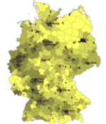
The following results are based on data of the Monitor of Settlement and Open Space Development (derived from the official geodata ATKIS Basic-DLM).

How much land is consumed in Germany?
Based on data of the Monitor of Settlement and Open Space Development (derived from the official geodata ATKIS Basic DLM), it has been possible to calculate statistics on land consumption in Germany since 2011. ...read more
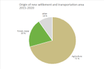
Which areas are getting build on?
Most of the new land take takes place on land formerly used for agriculture (77 %) ...read more
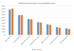
What is the trend in settlement density?
The settlement density in Germany is approx. 1,890 inhabitants/km² (IOER Monitor, 2020). ...read more
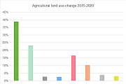
What trends are observed for the new indicator loss of open space per inhabitant?
Open space per inhabitant is spatially complementary to settlement density ...read more
How much land is sealed?
On the basis of the Europe-wide dataset on soil sealing (High Resolution Imperviousness Layer) published as part of the Copernicus Programme, the degree of sealing in Germany can be investigated at all scales. ...read more
Special evaluations
Inform yourself about the historical development of the German Autobahn, as well as changes in the accessibility and land usage around Autobahn interchanges.
[Application in German language]
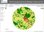
9 time slices (1790 to 2009) can be compared in interactive maps. They show the Urbanization of Dresden through settlement as well as landscape fragmentation due to higher density transport infrastructure over the time.
[Application in German language]
Publications
2021
- Schumacher, Ulrich
The Urban Mask Layer as Reference Geometry for Spatial Planning: Moving from German to European Geodata
KN - Journal of Cartography and Geographic Information; 2021; Springer - Andrian-Werburg, Stefan von; Buth, Mareike; Eichhorn, Daniel; Meinel, Gotthard; Theuring, Maria: Thematischer Umweltatlas: Medienwirksame Aufbereitung von Umweltinformationen durch Verknüpfung von räumlichen Darstellungen, Umweltdaten und Fachbeiträgen. Abschlussbericht. Dessau-Roßlau : Umweltbundesamt, 2021, S.76. URL: www.umweltbundesamt.de/publikationen/thematischer-umweltatlas-medienwirksame
- Behnisch, Martin; Krüger, Tobias; Jäger, Jochen: Trends der Zersiedelung in den deutschen Planungsregionen seit 1990. In: Meinel, Gotthard; Krüger, Tobias; Behnisch, Martin; Ehrhardt, Denise (Hrsg.) : Flächennutzungsmonitoring XIII. Flächenpolitik – Konzepte – Analysen – Tools. Berlin : Rhombos-Verlag, 2021, (IÖR-Schriften; 79), S.113-126
- Harig, Oliver; Hecht, Robert; Burghardt, Dirk; Meinel, Gotthard: Automatic Delineation of Urban Growth Boundaries Based on Topographic Data Using Germany as a Case Study. In: ISPRS International Journal of Geo-Information 10 (2021) 5: 353. DOI: doi.org/10.3390/ijgi10050353
- Hecht, Robert; Artmann, Martina; Brzoska, Patrycia; Burghardt, Dirk; Cakir, Sercan; Dunkel, Alexander; Gröbe, Mathias; Gugulica, Madalina; Krellenberg, Kerstin; Kreutzarek, Niklas; Lautenbach, Sven; Ludwig, Christina; Lümkemann, Dennis; Meinel, Gotthard; Schorcht, Martin; Sonnenbichler, Andreas; Stanley, Celina H.; Tenikl, Julia; Wurm, Michael; Zipf, Alexander: A web app to generate and disseminate new knowledge on urban green space qualities and their accessibility. In: ISPRS Annals of the Photogrammetry, Remote Sensing and Spatial Information Sciences (2021) VIII-4/W1-20, S.65-72. DOI: doi.org/10.5194/isprs-annals-VIII-4-W1-2021-65-2021
- Hecht, Robert; Brzoska, Patrycia; Burghardt, Dirk; Cakir, Sercan; Dunkel, Alexander; Gildhorn, Kai; Gröbe, Mathias; Gugulica, Madalina; Kreutzarek, Niklas; Lautenbach, Sven; Ludwig, Christina; Lümkemann, Dennis; Meinel, Gotthard; Rothert, Sören; Schorcht, Martin; Sonnenbichler, Andreas; Stanley, Celina H.; Tenikl, Julia; Wurm, Michael; Zipf, Alexander: Informationen und Navigation zu urbanen Grünflächen in Städten. Abschlussbericht und Handbuch zum mFUND-Projekt: meinGrün. Dresden : IÖR, 2021, S.126. URL: meingruen.ioer.info/fileadmin/user_upload/meingruen_sub/files/mFUND_19F2073A_meinGr%C3%BCn_Schlussbericht.pdf
- Herold, Hendrik: Big Historical Geodata for Urban and Environmental Research. In: Werner, Martin; Chiang, Yao-Yi (eds.) : Handbook of Big Geospatial Data. Cham : Springer, 2021, S.475-486. DOI: doi.org/10.1007/978-3-030-55462-0_18
- Islam, Md. Tariqul; Charlesworth, Mark; Mohammad, Aurangojeb; Hemstock, Sarah; Sikder, Sujit Kumar; Hassan, Md. Shareful; Dev, Papon Kumar; Hossain, Md. Zakir: Revisiting disaster preparedness in coastal communities since 1970s in Bangladesh with an emphasis on the case of tropical cyclone Amphan in May 2020. In: International Journal of Disaster Risk Reduction 58 (2021): 102175. DOI: doi.org/10.1016/j.ijdrr.2021.102175
- Jehling, Mathias; Krehl, Angelika; Krüger, Tobias: The more the merrier? Questioning the role of new commercial and industrial locations for employment growth in German city regions. In: Land Use Policy 109 (2021): 105653. DOI: doi.org/10.1016/j.landusepol.2021.105653
- Koetter, Theo; Sikder, Sujit Kumar; Weiss, Dominik: The cooperative urban land development model in Germany – An effective instrument to support affordable housing. In: Land Use Policy 107 (2021): 105481. DOI: doi.org/10.1016/j.landusepol.2021.105481
- Krüger, Tobias; Schorcht, Martin; Meinel, Gotthard: Zur Entwicklung der Flächenneuinanspruchnahme in Deutschland. In: Meinel, Gotthard; Krüger, Tobias; Behnisch, Martin; Ehrhardt, Denise (Hrsg.): Flächennutzungsmonitoring XIII. Flächenpolitik – Konzepte – Analysen – Tools. Berlin: Rhombos-Verlag, 2021, (IÖR-Schriften; 79), S.171-187
- Meinel, Gotthard: Siedlungs- und Landschaftsstruktur in Deutschland und deren Veränderungstendenzen. In: Strubelt, Wendelin; Dosch, Fabian; Meinel, Gotthard (Hrsg.) : Die Gestalt des Raumes. Landschaften Deutschlands als Abbilder der Gesellschaft. Berlin : Wasmuth & Zohlen Verlag, 2021, S.95-106
- Petry, Lisanne; Meiers, Thomas; Reuschenberg, David; Mirzavand Borujeni, Sara; Arndt, Jost; Odenthal, Luise; Erbertseder, Thilo; Taubenböck, Hannes; Müller, Inken; Kalusche, Elena; Weber, Beatrix;Käflein, Julian; Mayer, Christian; Meinel, Gotthard; Gengenbach, Christian; Herold, Hendrik: Design and results of an AI-based forecasting of air pollutants for smart cities. In: ISPRS Annals of the Photogrammetry, Remote Sensing and Spatial Information Sciences (2021) VIII-4/W1-20, S.89-96. DOI: doi.org/10.5194/isprs-annals-VIII-4-W1-2021-89-2021
- Schiller, Georg; Blum, Andreas; Hecht, Robert; Oertel, Holger; Ferber, Uwe; Meinel, Gotthard: Urban infill development potential in Germany: comparing survey and GIS data. In: Buildings and Cities 2 (2021) 1, S.36-54. DOI: doi.org/10.5334/bc.69
- Schwarz, Steffen; Hartmann, André; Hecht, Robert; Schorcht, Martin; Meinel, Gotthard; Behnisch, Martin: Schwarz, Steffen; Hartmann, André; Hecht, Robert; Schorcht, Martin; Meinel, Gotthard; Behnisch, Martin. In: zfv – Zeitschrift für Geodäsie, Geoinformation und Landmanagement 146 (2021) 03/2021, S.198-206. DOI: doi.org/10.12902/zfv-0352-2021
- Schwarz, Steffen; Schorcht, Martin; Hartmann, André; Meinel, Gotthard; Behnisch, Martin; Hecht, Robert: Zwischenbericht Forschungsdatenbank Nichtwohngebäude: E1.4.3 Teilbericht Erhebungsbezirke. Dresden: IÖR, 2021, S.1-17. URL: www.datanwg.de/fileadmin/user/iwu/IOER_Teilbericht_E-1-4-4_Zwischenbericht_Erhebungsbezirke_20210422_FINAL.pdf
- Strubelt, Wendelin; Dosch, Fabian; Meinel, Gotthard (Hrsg.): Die Gestalt des Raumes. Landschaften Deutschlands als Abbilder der Gesellschaft. Berlin: Wasmuth & Zohlen Verlag, 2021, S.420
- Walz, Ulrich; Krüger, Tobias; Schumacher, Ulrich: Landschaftszerschneidung und Waldfragmentierung in Deutschland – Analyseergebnisse aus dem IÖR-Monitor. In: Meinel, Gotthard; Krüger, Tobias; Behnisch, Martin; Ehrhardt, Denise (Hrsg.) : Flächennutzungsmonitoring XIII. Flächenpolitik – Konzepte – Analysen – Tools. Berlin : Rhombos-Verlag, 2021, (IÖR-Schriften; 79), S.127-137
2020
- Bensmann, Felix; Heling, Lars; Jünger, Stefan; Mucha, Loren; Acosta, Maribel; Goebel, Jan; Meinel, Gotthard; Sikder, Sujit Kumar; Sure-Vetter, York; Zapilko, Benjamin (2020): An infrastructure for spatial linking of survey data. In: Data Science Journal 19 (2020) 1 (27), S. 1-18. doi.org/10.5334/dsj-2020-027
- Bill, Ralf; Lorenzen-Zabel, Axel; Hinz, Matthias; Kalcher, Jasmin; Pfeiffer, Alexandra; Brosowski, Andre; Aberle, Henning; Hovenbitzer, Michael; Meinel, Gotthard; Sikder, Sujit Kumar; Herold, Hendrik (2020): OpenGeoEdu – a massive open online course on using open geodata. In: ISPRS Annals of the Photogrammetry, Remote Sensing and Spatial Information Sciences; Volume V-5-2020, 2020, S.31-38. doi.org/10.5194/isprs-annals-V-5-2020-31-2020
- Blechschmidt, Johannes; Meinel, Gotthard (2020): Eine Methodik zur Abschätzung der zukünftigen Flächenneuinanspruchnahme anhand von Bebauungsplänen. In: Meinel, Gotthard; Schumacher, Ulrich; Behnisch, Martin; Krüger, Tobias (Hrsg.): Flächennutzungsmonitoring XII mit Beiträgen zum Monitoring von Ökosystemleistungen und SDGs. Berlin: Rhombos-Verlag (IÖR-Schriften; 78), S.105-116.
- Meinel, Gotthard (2020): Herausforderung Flächenmonitoring: Datenquellen für ein Flächeninformationssystem und was sie leisten können. In: Stadtforschung und Statistik 33 (2020) 1, S.107-114. nbn-resolving.org/urn:nbn:de:0168-ssoar-67123-7
- Meinel, Gotthard; Henger, Ralph; Krüger, Tobias; Schmidt, Tom; Schorcht, Martin (2020): Wer treibt die Flächeninanspruchnahme? Ein Planvergleich und deren Flächenwirkung. In: Raumforschung und Raumordnung 78 (2020) 3, S. 233-248. doi.org/10.2478/rara-2020-0003 (Online First)
- Meinel, Gotthard; Reiter, Denis; Walz, Ulrich; Hennersdorf, Jörg (2020): Digitale Bodenrichtwerte – Datenlage, Analysepotenzial und ausgewählte Ergebnisse zur Siedlungs- und Freiraumentwicklung. In: Meinel, Gotthard; Schumacher, Ulrich; Behnisch, Martin; Krüger, Tobias (Hrsg.): Flächennutzungsmonitoring XII mit Beiträgen zum Monitoring von Ökosystemleistungen und SDGs. Berlin: Rhombos-Verlag (IÖR-Schriften; 78), S.271-280.
- Siedentop, Stefan; Meinel, Gotthard (2020): 30-Hektar-Ziel erreicht? Wie flächensparend haben sich deutsche Stadtregionen entwickelt? In: Meinel, Gotthard; Schumacher, Ulrich; Behnisch, Martin; Krüger, Tobias (Hrsg.): Flächennutzungsmonitoring XII mit Beiträgen zum Monitoring von Ökosystemleistungen und SDGs. Berlin: Rhombos-Verlag (IÖR-Schriften; 78), S.85-94.
2019
- Artmann, Martina; Kohler, Manon; Meinel, Gotthard; Gan, Jing; Ioja, Ioan-Cristian: How smart growth and green infrastructure can mutually support each other – A conceptual framework for compact and green cities. In: Ecological Indicators 96 (2019) Part 2, S. 10-22. DOI: http://dx.doi.org/10.1016/j.ecolind.2017.07.001
- Behnisch, Martin; Hecht, Robert; Herold, Hendrik; Jiang, Bin (Guest Editors): Special Issue “Urban Big Data analytics and morphology”. In: Environment and Planning B: Urban Analytics and City Science 46 (2019) 7. DOI: https://doi.org/10.1177/2399808319870016
- Behnisch, Martin; Schorcht, Martin; Kriewald, Steffen; Rybski, Diego: Settlement percolation: A study of building connectivity and poles of inaccessibility. In: Landscape and Urban Planning 191 (2019) 103631. DOI: https://doi.org/10.1016/j.landurbplan.2019.103631
- Behnisch, Martin; Schorcht, Martin; Poglitsch, Hanna; Reiter, Denis: Pole der Unerreichbarkeit in Deutschland. In: Meinel, Gotthard; Schumacher, Ulrich; Behnisch, Martin; Krüger, Tobias (Hrsg.): Flächennutzungsmonitoring XI: Flächenmanagement – Bodenversiegelung – Stadtgrün. Berlin: Rhombos-Verlag, 2019 (IÖR-Schriften; 77), S. 305-311.
- Eichhorn, Daniel; Neuberger, Alexander: Der neue UBA-Umweltatlas und der Baustein „Bauen, Wohnen, Haushalte“. In: Meinel, Gotthard; Schumacher, Ulrich; Behnisch, Martin; Krüger, Tobias (Hrsg.): Flächennutzungsmonitoring XI: Flächenmanagement – Bodenversiegelung – Stadtgrün. Berlin: Rhombos-Verlag, 2019 (IÖR-Schriften; 77), S. 277-285.
- Eichler, Lisa: Unter vier Augen – Erkenntnisse aus einer Eyetracking-Studie zum IÖR-Monitor. In: Meinel, Gotthard; Schumacher, Ulrich; Behnisch, Martin; Krüger, Tobias (Hrsg.): Flächennutzungsmonitoring XI: Flächenmanagement – Bodenversiegelung – Stadtgrün. Berlin: Rhombos-Verlag, 2019 (IÖR-Schriften; 77), S. 331-336.
- Göhler, Laura; Walz, Ulrich; Krüger, Tobias: Entwicklung der Photovoltaik-Freiflächenanlagen in Deutschland – auf Grundlage des ATKIS Basis-DLM. In: Meinel, Gotthard; Schumacher, Ulrich; Behnisch, Martin; Krüger, Tobias (Hrsg.): Flächennutzungsmonitoring XI: Flächenmanagement – Bodenversiegelung – Stadtgrün. Berlin: Rhombos-Verlag, 2019 (IÖR-Schriften; 77), S. 149-158.
- Grunewald, Karsten; Richter, Benjamin; Behnisch, Martin: Multi-indicator approach for characterising urban green space provision at city and city-district level in Germany. In: International Journal of Environmental Research and Public Health 16 (2019) 2300, S. 1-20. DOI: https://doi.org/10.3390/ijerph16132300
- Gutting, Robin; Hübsch, Babett; Meinel, Gotthard; Wende, Wolfgang: Raumbezogenes Storytelling in der Mensch-Umwelt-Bildung. Möglichkeiten und Grenzen des Editorensystems „Story Maps“ von ESRI. In: Naturschutz und Landschaftsplanung 51 (2019) 8, S. 2-8.
- Hecht, Robert; Herold, Hendrik; Behnisch, Martin; Jehling, Mathias: Mapping long-term dynamics of population and dwellings based on a multi-temporal analysis of urban morphologies. In: ISPRS International Journal of Geo-Information 8 (2019) 1, Nr. 2, S. 1-21. DOI: https://doi.org/10.3390/ijgi8010002
- Jehling, Mathias; Albrecht, Juliane; Schaser, Christian: Je schneller, desto besser? – Chancen und Risiken beschleunigter Verfahren in der Bauleitplanung. In: Meinel, Gotthard; Schumacher, Ulrich; Behnisch, Martin; Krüger, Tobias (Hrsg.): Flächennutzungsmonitoring XI: Flächenmanagement – Bodenversiegelung – Stadtgrün. Berlin: Rhombos-Verlag, 2019 (IÖR-Schriften; 77), S. 65-76.
- Jehling, Mathias; Hitzeroth, Marion; Brueckner, Martin: Applying institutional theory to the analysis of energy transitions: From local agency to multi-scale configurations in Australia and Germany. In: Energy Research & Social Science 53 (2019), S. 110-120. DOI: https://doi.org/10.1016/j.erss.2019.01.018
- Jünger, Stefan; Mucha, Loren; Meinel, Gotthard: Die Sozial-Raumwissenschaftliche Forschungsdateninfrastruktur SoRa – Potenziale und Implementierung. In: Meinel, Gotthard; Schumacher, Ulrich; Behnisch, Martin; Krüger, Tobias (Hrsg.): Flächennutzungsmonitoring XI: Flächenmanagement – Bodenversiegelung – Stadtgrün. Berlin: Rhombos-Verlag, 2019 (IÖR-Schriften; 77), S. 139-148.
- Krellenberg, Kerstin; Artmann, Martina; Hecht, Robert; Stanley, Celina: Wissen zum Stadtgrün durch neue Datenzugänge verbessern. In: Meinel, Gotthard; Schumacher, Ulrich; Behnisch, Martin; Krüger, Tobias (Hrsg.): Flächennutzungsmonitoring XI: Flächenmanagement – Bodenversiegelung – Stadtgrün. Berlin: Rhombos-Verlag, 2019 (IÖR-Schriften; 77), S. 237-241.
- Krüger, Tobias; Schorcht, Martin; Hartmann, André: Entwicklung der Nutzungsintensität baulich geprägter Siedlungsflächen in Deutschland. In: Meinel, Gotthard; Schumacher, Ulrich; Behnisch, Martin; Krüger, Tobias (Hrsg.): Flächennutzungsmonitoring XI: Flächenmanagement – Bodenversiegelung – Stadtgrün. Berlin: Rhombos-Verlag, 2019 (IÖR-Schriften; 77), S. 199-208.
- Meinel, Gotthard; Reiter, Denis: Nutzung des Landbedeckungsmodells LBM-DE für das Flächenmonitoring – Bewertung und Ergebnisse. In: Meinel, Gotthard; Schumacher, Ulrich; Behnisch, Martin; Krüger, Tobias (Hrsg.): Flächennutzungsmonitoring XI: Flächenmanagement – Bodenversiegelung – Stadtgrün. Berlin: Rhombos-Verlag, 2019 (IÖR-Schriften; 77), S. 169-179.
- Meinel, Gotthard; Schumacher, Ulrich; Behnisch, Martin; Krüger, Tobias (Hrsg.): Flächennutzungsmonitoring XI. Flächenmanagement – Bodenversiegelung – Stadtgrün. Berlin: Rhombos-Verlag, 2019 (IÖR Schriften; 77), 344 S.
- Richter, Benjamin; Behnisch, Martin: Integrated evaluation framework for environmental planning in the context of compact green cities. In: Ecological Indicators 96 (2019) Part 2, S. 38-53. DOI: https://doi.org/10.1016/j.ecolind.2018.05.025
- Sikder, Sujit Kumar; Behnisch, Martin; Herold, Hendrik; Koetter, Theo: Geospatial analysis of building structures in Megacity Dhaka: the use of spatial statistics for promoting data-driven decision-making. In: Journal of Geovisualization and Spatial Analysis 3 (2019) 1, Art. 7, S. 1-14. DOI: https://doi.org/10.1007/s41651-019-0029-y
2018
- Behnisch, Martin; Jaeger, Jochen A. G.; Krüger, Tobias: Welche Vorteile bietet die Quantifizierung der Zersiedelung? In: Nachrichten der ARL (2018) 1, S.25-30
- Behnisch, Martin; Kretschmer, Odette; Meinel, Gotthard (Hrsg.): Flächeninanspruchnahme in Deutschland: Auf dem Wege zu einem besseren Verständnis der Siedlungs- und Verkehrsflächenentwicklung. Berlin: Springer Spektrum, 2018. DOI: https://doi.org/10.1007/978-3-662-50305-8
- Eichhorn, Daniel; Rosteck, Ullrich: Wohnungsbaumonitoring Sachsen – Wie sehen die Perspektiven und Trends aus? In: Meinel, Gotthard; Schumacher, Ulrich; Behnisch, Martin; Krüger, Tobias (Hrsg.): Flächennutzungsmonitoring X: Flächenpolitik – Flächenmanagement – Indikatoren. Berlin: Rhombos-Verlag, 2018 (IÖR-Schriften; 76), S. 315-323.
- Herold, Hendrik; Meinel, Gotthard: Digitale Erhebung der historischen Flächennutzung Deutschlands. In: Meinel, Gotthard; Schumacher, Ulrich; Behnisch, Martin; Krüger, Tobias (Hrsg.): Flächennutzungsmonitoring X: Flächenpolitik – Flächenmanagement – Indikatoren. Berlin: Rhombos-Verlag, 2018 (IÖR-Schriften; 76), S. 187-193.
- Jehling, Mathias; Krüger, Tobias; Meinel, Gotthard: Vergleichende Stadtteilanalytik – Ansätze auf Basis des IÖR-Monitors. In: Meinel, Gotthard; Schumacher, Ulrich; Behnisch, Martin; Krüger, Tobias (Hrsg.): Flächennutzungsmonitoring X: Flächenpolitik – Flächenmanagement – Indikatoren. Berlin: Rhombos-Verlag, 2018 (IÖR-Schriften; 76), S. 217-225.
- Jehling, Mathias; Meinel, Gotthard; Michel, Christin: Institutionelle Landschaft der Flächenpolitik: Strukturierung und Konzeption eines Wissensportals. In: Meinel, Gotthard; Schumacher, Ulrich; Behnisch, Martin; Krüger, Tobias (Hrsg.): Flächennutzungsmonitoring X: Flächenpolitik – Flächenmanagement – Indikatoren. Berlin: Rhombos-Verlag, 2018 (IÖR-Schriften; 76), S. 35-44.
- Meinel, Gotthard; Krüger, Tobias; Schorcht, Martin; Hübsch, Babett: Wie nachhaltig ist die Flächennutzungsentwicklung Deutschlands? Aktuelle Befunde des IÖR-Monitors. In: Meinel, Gotthard; Schumacher, Ulrich; Behnisch, Martin; Krüger, Tobias (Hrsg.): Flächennutzungsmonitoring X: Flächenpolitik – Flächenmanagement – Indikatoren. Berlin: Rhombos-Verlag, 2018 (IÖR-Schriften; 76), S. 67-77.
- Meinel, Gotthard; Schumacher, Ulrich; Behnisch, Martin; Krüger, Tobias (Hrsg.): Flächennutzungsmonitoring X. Flächenpolitik – Flächenmanagement – Indikatoren. Berlin: Rhombos-Verlag, 2018 (IÖR Schriften; 76), 335 S.
- Poglitsch, Hanna; Hartmann, André; Schwarz, Steffen; Hecht, Robert; Eisenlohr, Johannes; Ferrara, Claudio; Behnisch, Martin: Eine Frage des Flächensparens: Wo können eine Milliarde Photovoltaik-Module in Deutschland installiert werden? In: Meinel, Gotthard; Schumacher, Ulrich; Behnisch, Martin; Krüger, Tobias (Hrsg.): Flächennutzungsmonitoring X: Flächenpolitik – Flächenmanagement – Indikatoren. Berlin: Rhombos-Verlag, 2018 (IÖR-Schriften; 76), S. 133-143.
- Sikder, Sujit Kumar; Herold, Hendrik; Meinel, Gotthard: Infrastrukturplanung mit verkehrsbezogenen Flächennutzungsindikatoren. In: Meinel, Gotthard; Schumacher, Ulrich; Behnisch, Martin; Krüger, Tobias (Hrsg.): Flächennutzungsmonitoring X: Flächenpolitik – Flächenmanagement – Indikatoren. Berlin: Rhombos-Verlag, 2018 (IÖR-Schriften; 76), S. 261-269.
- Walz, Ulrich; Schumacher, Ulrich; Krüger, Tobias: Freiraumindikatoren im IÖR-Monitor – Stand und Entwicklung. In: Meinel, Gotthard; Schumacher, Ulrich; Behnisch, Martin; Krüger, Tobias (Hrsg.): Flächennutzungsmonitoring X: Flächenpolitik – Flächenmanagement – Indikatoren. Berlin: Rhombos-Verlag, 2018 (IÖR-Schriften; 76), S. 293-303.
2017
- Grunewald, Karsten; Richter, Benjamin; Meinel, Gotthard; Herold, Hendrik; Syrbe, Ralf-Uwe: Proposal of indicators regarding the provision and accessibility of green spaces for assessing the ecosystem service „recreation in the city“ in Germany, In: International Journal of Biodiversity Science, Ecosystem Services and Management 13 (2017) 2, S. 26-39, http://dx.doi.org/10.1080/21513732.2017.1283361
- Grunewald, Karsten; Richter, Benjamin; Syrbe, Ralf-Uwe; Meinel, Gotthard: Indikatorbasierte Beschreibung von Ökosystemleistungen im IÖR-Monitor, In: Meinel, Gotthard; Schumacher, Ulrich; Schwarz, Steffen; Richter, Benjamin (Hrsg.) : Flächennutzungsmonitoring IX: Nachhaltigkeit der Siedlungs- und Verkehrsentwicklung?. Berlin : Rhombos-Verlag, 2017, (IÖR-Schriften; 73), S. 241-248
- Grunewald, Karsten; Syrbe, Ralf-Uwe; Walz, Ulrich; Richter, Benjamin; Meinel, Gotthard; Herold, Hendrik; Marzelli, Stefan: Germany’s ecosystem services – state of the indicator development for a nationwide assessment and monitoring, In: One Ecosystem 2 (2017) Nr. e14021, S. 1-18, https://doi.org/10.3897/oneeco.2.e14021
- Grunewald, Karsten; Syrbe, Ralf-Uwe; Walz, Ulrich; Richter, Benjamin; Meinel, Gotthard; Herold, Hendrik; Marzelli, Stefan: Ökosystemleistungen Deutschlands. Stand der Indikatorenentwicklung für ein bundesweites Assessment und Monitoring, In: Natur und Landschaft 92 (2017) 11, S. 485-492, http://dx.doi.org/10.17433/11.2017.50153517.485-492
- Herold, Hendrik; Hecht, Robert; Meinel, Gotthard: Reconstruction of the land-use development with old maps, In: Proceedings of the 28th International Cartographic Conference (ICC2017), July 1-8th, Washington DC, USA, 2017, S. 1-4, http://www.eventscribe.com//2017/ICC/assets/handouts/511694.pdf
- Krüger, Tobias; Schorcht, Martin; Behnisch, Martin; Meinel, Gotthard: Aktuelle Befunde des IÖR-Monitors zur Flächenneuinanspruchnahme in Deutschland, In: Meinel, Gotthard; Schumacher, Ulrich; Schwarz, Steffen; Richter, Benjamin (Hrsg.) : Flächennutzungsmonitoring IX: Nachhaltigkeit der Siedlungs- und Verkehrsentwicklung?. Berlin : Rhombos-Verlag, 2017, (IÖR-Schriften; 73), S. 11-20
- Meinel, Gotthard: Bestimmung der Flächenneuinanspruchnahme auf Grundlage der Bautätigkeitsstatistik – konzeptionelle Überlegungen, In: Meinel, Gotthard; Schumacher, Ulrich; Schwarz, Steffen; Richter, Benjamin (Hrsg.) : Flächennutzungsmonitoring IX: Nachhaltigkeit der Siedlungs- und Verkehrsentwicklung?. Berlin : Rhombos-Verlag, 2017, (IÖR-Schriften; 73), S. 179-188
- Meinel, Gotthrd; Schumacher, Ulrich; Schwarz, Steffen; Richter, Benjamin (Hrsg.): Flächennutzungsmonitoring IX: Nachhaltigkeit der Siedlungs- und Verkehrsentwicklung?, Berlin : Rhombos-Verlag, 2017, S. 326 (IÖR-Schriften; 73)
- Müller, Nicole; Hecht, Robert; Buchholz, Saskia: Bebauungsstrukturklassifikation in NRW – Grundlage für Klimamodellsimulationen, In: Meinel, Gotthard; Schumacher, Ulrich; Schwarz, Steffen; Richter, Benjamin (Hrsg.) : Flächennutzungsmonitoring IX: Nachhaltigkeit der Siedlungs- und Verkehrsentwicklung?. Berlin : Rhombos-Verlag, 2017, (IÖR-Schriften; 73), S. 81-91
- Richter, Benjamin; Behnisch, Martin; Grunewald, Karsten: Messansatz zur Grünflächenversorgung von Einwohnern auf Stadt- und Stadtteilebene, In: Meinel, Gotthard; Schumacher, Ulrich; Schwarz, Steffen; Richter, Benjamin (Hrsg.) : Flächennutzungsmonitoring IX: Nachhaltigkeit der Siedlungs- und Verkehrsentwicklung?. Berlin : Rhombos-Verlag, 2017, (IÖR-Schriften; 73), S. 229-239
2016
- Grunewald, Karsten; Herold, Hendrik; Marzelli, Stefan; Meinel, Gotthard; Richter, Benjamin; Syrbe, Ralf-Uwe; Walz, Ulrich: Assessment of ecosystem services at the national level in Germany – Illustration of the concept and the development of indicators by way of the example wood provision, In: Ecological Indicators 70 (2016), S. 181-195, http://dx.doi.org/10.1016/j.ecolind.2016.06.010
- Grunewald, Karsten; Richter, Benjamin; Meinel, Gotthard; Herold, Hendrik; Syrbe, Ralf-Uwe: Vorschlag bundesweiter Indikatoren zur Erreichbarkeit öffentlicher Grünflächen : Bewertung der Ökosystemleistung „Erholung in der Stadt“, In: Naturschutz und Landschaftsplanung 48 (2016) 7, S. 218-226
- Grunewald, Karsten; Herold, Hendrik; Marzelli, Stefan; Meinel, Gotthard; Richter, Benjamin; Syrbe, Ralf-Uwe; Walz, Ulrich: Konzept nationale Ökosystemleistungs-Indikatoren Deutschland; In: Naturschutz und Landschaftsplanung 48 (2016) 5, S. 141-152
- Hartmann, André; Hecht, Robert; Behnisch, Martin; Meinel, Gotthard: Gebäudebestandsmonitoring – Prozessierungsschritte für den Aufbau homogener Gebäudedatensätze, In: Meinel, Gotthard; Förtsch, Daniela; Schwarz, Steffen; Krüger, Tobias (Hrsg.) : Flächennutzungsmonitoring VIII : Flächensparen – Ökosystemleistungen – Handlungsstrategien. Berlin : Rhombos-Verlag, 2016, (IÖR-Schriften; 69), S. 203-214
- Hartmann, André; Meinel, Gotthard; Hecht, Robert; Behnisch, Martin: A workflow for automatic quantification of structure and dynamic of the German building stock using official spatial data, In: ISPRS International Journal of Geo-Information 5 (2016) 8, Nr. 142, S. 30, http://dx.doi.org/10.3390/ijgi5080142
- Herold, Hendrik; Hecht, Robert; Meinel, Gotthard: Old maps for land use change monitoring – analysing historical maps for long-term land use change monitoring, In: van Dijk, Thomas C.; Schommer, Christoph (Hrsg.) : Proceedings of the International Workshop Exploring Old Maps (EOM 2016), University of Luxembourg, Esch-sur-Alzette, Luxembourg, 08 June 2016, 2016, S. 11-12
- Meinel, Gotthard; Förtsch, Daniela; Schwarz, Steffen; Krüger, Tobias (Hrsg.): Flächennutzungsmonitoring VIII : Flächensparen – Ökosystemleistungen – Handlungsstrategien, Berlin : Rhombos-Verlag, 2016, S. 345
(IÖR-Schriften; 69) - Meinel, Gotthard; Herold, Hendrik; Hecht, Robert; Krüger, Tobias: Studie zur Implementierung einer Innenentwicklungspotenzial-Flächenerhebung in die amtliche Statistik, Bonn : BBSR, 2016, S. 14 (BBSR-Online-Publikation)
- Muhs, Sebastian; Herold, Hendrik; Meinel, Gotthard; Burkhardt, Dirk; Kretschmer, Odette: Automatic delineation of built-up area at urban block level from topographic maps: In: Computers, Environment and Urban Systems 58 (2016), S. 71-8
- Krüger, Tobias; Meinel, Gotthard; Behnisch, Martin; Schorcht, Martin: Hochwasserrisiko und Bodenversiegelung: neue Ergebnisse des IÖR-Monitors, In: Meinel, Gotthard; Förtsch, Daniela; Schwarz, Steffen; Krüger, Tobias (Hrsg.) : Flächennutzungsmonitoring VIII : Flächensparen – Ökosystemleistungen – Handlungsstrategien. Berlin : Rhombos-Verlag, 2016, (IÖR-Schriften; 69), S. 193-201
- Richter, Benjamin; Grunewald, Karsten; Meinel, Gotthard: Urbane Grünflächenausstattung und deren Erreichbarkeit – Indikatordesign und empirischer Städtevergleich, In: Meinel, Gotthard; Förtsch, Daniela; Schwarz, Steffen; Krüger, Tobias (Hrsg.) : Flächennutzungsmonitoring VIII : Flächensparen – Ökosystemleistungen – Handlungsstrategien. Berlin : Rhombos-Verlag, 2016, (IÖR-Schriften; 69), S.293-303
- Richter, Benjamin; Grunewald, Karsten; Meinel, Gotthard: Analyse von Wegedistanzen in Städten zur Verifizierung des Ökosystemleistungsindikators „Erreichbarkeit städtischer Grünflächen“, In: AGIT - Journal für Angewandte Geoinformatik (2016) 2, S.472-781, http://dx.doi.org/10.14627/537622063
- Schorcht, Martin; Krüger, Tobias; Meinel, Gotthard: Measuring land take: usability of national topographic databases as input for land use change analysis: a case study from Germany, In: ISPRS International Journal of Geo-Information 5 (2016) 8, Nr. 134, S. 20, http://dx.doi.org/10.3390/ijgi5080134
- Syrbe, Ralf-Uwe; Schorcht, Martin; Grunewald, Karsten; Meinel, Gotthard: Indikatoren für Ökosystemleistungen am Beispiel der Regulierung der Bodenerosion, In: Meinel, Gotthard; Förtsch, Daniela; Schwarz, Steffen; Krüger, Tobias (Hrsg.) : Flächennutzungsmonitoring VIII : Flächensparen – Ökosystemleistungen – Handlungsstrategien. Berlin : Rhombos-Verlag, 2016, (IÖR-Schriften; 69), S.281-291
2015
- Krüger, Tobias; Hennersdorf, Jörg; Meinel, Gotthard; Behnisch, Martin: Migration des ATKIS-Basis-DLM - Auswirkungen auf die Nutzung für das Flächenmonitoring, In: Kartographische Nachrichten 65 (2015) 2, S.59-66
- Meinel, Gotthard; Krüger, Tobias; Hennersdorf, Jörg; Schorcht, Martin; Förster, Jochen; Schumacher, Ulrich: Flächennutzungsentwicklung in Deutschland - Erkenntnisse aus dem IÖR-Monitor: In: Meinel, Gotthard; Schumacher, Ulrich; Behnisch, Martin; Krüger, Tobias (Hrsg.) : Flächennutzungsmonitoring VII: Boden, Flächenmanagement, Analysen und Szenarien. Berlin : Rhombos-Verlag, 2015, (IÖR-Schriften; 67), S.51-58
- Meinel, Gotthard; Schumacher, Ulrich; Behnisch, Martin; Krüger, Tobias (Hrsg.): Flächennutzungsmonitoring VII: Boden, Flächenmanagement, Analysen und Szenarien, Berlin : Rhombos-Verlag, 2015, S.352, (IÖR-Schriften; 67)
- Schorcht, Martin; Krüger, Tobias; Meinel, Gotthard: Methodik zur Bilanzierung des Flächennutzungswandels, In: Meinel, Gotthard; Schumacher, Ulrich; Behnisch, Martin; Krüger, Tobias (Hrsg.) : Flächennutzungsmonitoring VII: Boden, Flächenmanagement, Analysen und Szenarien. Berlin : Rhombos-Verlag, 2015, (IÖR-Schriften; 67), S.181-190
- Hecht, Robert; Meinel, Gotthard; Buchroithner, Manfred F.: Automatic identification of building types based on topographic databases - A comparison of different data sources, In: International Journal of Cartography 1 (2015) 1, S.18-31, DOI 10.1080/23729333.2015.1055644
- Kunze, Carola; Hecht, Robert: Semantic enrichment of building data with volunteered geographic information to improve mappings of dwelling units and population, In: Computers, Environment and Urban Systems 53 (2015), S. 4-18, http://dx.doi.org/10.1016/j.compenvurbsys.2015.04.002
- Meinel, Gotthard: Flächennutzung in Deutschland - Was Geobasisdaten verraten, arcAKTUELL, 1/2015, S.22-23
- Neubert, Marco; Schumacher, Ulrich; Krüger, Tobias; Meinel, Gotthard: Überschwemmungsgebiets-Geometrie zur Berechnung deutschlandweiter Risikoindikatoren. In: AGIT-Journal für Angewandte Geoinformatik (2015) 1, S.246-251
- Jahn, Alexandra; Hecht, Robert; Meinel, Gotthard: 3D-Gebäudemodelle : Grundlage siedlungsstruktureller Analysen am Beispiel Sachsens, In: Meinel, Gotthard; Schumacher, Ulrich; Behnisch, Martin; Krüger, Tobias (Hrsg.) : Flächennutzungsmonitoring VII : Boden, Flächenmanagement, Analysen und Szenarien. Berlin : Rhombos-Verlag, 2015, (IÖR-Schriften; 67), S. 233-243
- Walz, Ulrich; Grunewald, Karsten; Herold, Hendrik; Richter, Benjamin; Syrbe, Ralf-Uwe; Meinel, Gotthard; Marzelli, Stefan:Bundesweite Indikatoren zu Ökosystemleistungen, In: Meinel, Gotthard; Schumacher, Ulrich; Behnisch, Martin; Krüger, Tobias (Hrsg.) : Flächennutzungsmonitoring VII : Boden, Flächenmanagement, Analysen und Szenarien. Berlin : Rhombos-Verlag, 2015, (IÖR-Schriften; 67), S. 279-288
2014
- Harig, Oliver; Hecht, Robert; Meinel, Gotthard (2014): Automatisierte Abgrenzung von Innenbereichen auf Grundlage von Geobasisdaten. In: Meinel, Gotthard; Schumacher, Ulrich; Behnisch, Martin (Hrsg.): Flächennutzungsmonitoring VI. Innenentwicklung - Prognose - Datenschutz. Berlin: Rhombos (IÖR Schriften 65), S.113-120.
- Hecht, Robert; Meinel, Gotthard (2014): Automatisierte Erfassung von Innenentwicklungspotenzialen auf Grundlage von Geobasisdaten - Möglichkeiten und Grenzen. In: Meinel, Gotthard; Schumacher, Ulrich; Behnisch, Martin (Hrsg.): Flächennutzungsmonitoring VI. Innenentwicklung - Prognose - Datenschutz. Berlin: Rhombos (IÖR Schriften 65), S.103-112.
- Herold, Hendrik; Meinel, Gotthard; Hecht, Robert; Krüger, Tobias (2014): Bundesweites Monitoring von Innenentwicklungspotenzialen - Ausgangslage und Perspektive. In: Meinel, Gotthard; Schumacher, Ulrich; Behnisch, Martin (Hrsg.): Flächennutzungsmonitoring VI. Innenentwicklung - Prognose - Datenschutz. Berlin: Rhombos (IÖR Schriften 65), S.93-101.
- Meinel, Gotthard (2014): Die Entwicklung von Siedlung und Freiraum in Deutschland - Datengrundlage, Methodik und ausgewählte Ergebnisse des IÖR-Monitors. In: Kolbe, T. H.; Bill, R.; Donaubauer, A. (Hrsg.): Geoinformationssysteme 2014 - Beiträge zur 1. Münchner GI-Runde. Berlin: Wichmann, S.126-135.
- Meinel, Gotthard (2014): Monitor der Siedlungs- und Freiraumentwicklung - deutschlandweite indikatorbasierte Informationen zur Flächennutzungsstruktur. In: PlanerIn (2014) 2, S.45-46.
- Meinel, Gotthard; Schumacher, Ulrich; Behnisch, Martin (Hrsg.) (2014): Flächennutzungsmonitoring VI. Innenentwicklung - Prognose - Datenschutz. Berlin: Rhombos (IÖR Schriften 65).
- Meinel, Gotthard; Krüger, Tobias; Schumacher, Ulrich; Hennersdorf, Jörg; Förster, Jochen; Köhler, Christiane; Walz, Ulrich; Stein, Christian (2014): Aktuelle Trends der Flächennutzungsentwicklung, neue Indikatoren und Funktionalitäten des IÖR-Monitors. In: Meinel, Gotthard; Schumacher, Ulrich; Behnisch, Martin (Hrsg.): Flächennutzungsmonitoring VI. Innenentwicklung - Prognose - Datenschutz. Berlin: Rhombos (IÖR Schriften 65), S.35-43.
- Schiller, Georg; Blum, Andreas; Hecht, Robert; Meinel, Gotthard; Oertel, Holger; Ferber, Uwe; Petermann, Eric (2014): Innenentwicklungspotenziale in Deutschland - Ergebnisse einer bundesweiten Umfrage und Möglichkeiten einer automatisierten Abschätzung. Bonn: BBSR, S.163.
- Schwarzak, Marco; Behnisch, Martin; Meinel, Gotthard (2014): Zersiedelung in Deutschland - erste Ergebnisse nach Schweizer Messkonzept. In: Meinel, Gotthard; Schumacher, Ulrich; Behnisch, Martin (Hrsg.): Flächennutzungsmonitoring VI. Innenentwicklung - Prognose - Datenschutz. Berlin: Rhombos (IÖR Schriften 65), S.213-222.
- Walz, Ulrich; Koldrack, Nils; Bill, Ralf (2014): Flächeninanspruchnahme für erneuerbare Energien in Deutschland - Datengrundlagen und erste Ergebnisse. In: Meinel, Gotthard; Schumacher, Ulrich; Behnisch, Martin (Hrsg.): Flächennutzungsmonitoring VI. Innenentwicklung - Prognose - Datenschutz. Berlin: Rhombos (IÖR Schriften 65), S.45-53.
- Walz, Ulrich; Stein, Christian (2014): Indicators of hemeroby for the monitoring of landscapes in Germany. In: Journal for Nature Conservation 22(2014)3, 279-289.
2013
- Behnisch, Martin; Hagemann, Ulrike; Meinel, Gotthard (2013): Analyseergebnisse zum Gebäudebestand in Deutschland auf der Grundlage von Geobasisdaten. In: Meinel, Gotthard; Schumacher, Ulrich; Behnisch, Martin (Hrsg.): Flächennutzungsmonitoring V. Methodik - Analyseergebnisse - Flächenmanagement. Berlin: Rhombos (IÖR Schriften 61), S.231-241.
- Dießelmann, Markus; Meinel, Gotthard (2013): Zur Erzeugung hochauflösender datenschutzkonformer Mischrasterkarten. In: Meinel, Gotthard; Schumacher, Ulrich; Behnisch, Martin (Hrsg.): Flächennutzungsmonitoring V. Methodik – Analyseergebnisse – Flächenmanagement. Berlin: Rhombos (IÖR Schriften 61), S.189-197
- Hecht, Robert (2013): Automatische Erkennung von Gebäudetypen auf Grundlage von Geobasisdaten. In: Meinel, Gotthard; Schumacher, Ulrich; Behnisch, Martin (Hrsg.): Flächennutzungsmonitoring V. Methodik – Analyseergebnisse – Flächenmanagement. Berlin: Rhombos (IÖR Schriften 61), S.199-210
- Krüger, Tobias; Meinel, Gotthard; Schumacher, Ulrich (2013): Land-use monitoring by topographic data analysis. In: Cartography and Geographic Information Science 40(2013)3, 220-228.
- Meinel, Gotthard (2013): Auf dem Weg zu einer besseren Flächennutzungsstatistik. In: Raumforschung und Raumordnung 71(2013)6, S.487-495.
- Meinel, Gotthard; Behnisch, Martin; Walz, Ulrich (2013): Environmental Indicators of the Monitor of Settlement and Open Space Development in Germany. In: ICEI 2013 - 20th International Conference on Environmental Indicators, Trier University, Germany. Trier, 43-45.
- Meinel, Gotthard; Schumacher, Ulrich; Behnisch, Martin (Hrsg.) (2013): Flächennutzungsmonitoring V. Methodik - Analyseergebnisse - Flächenmanagement, Berlin: Rhombos (IÖR Schriften 61).
- Meinel, Gotthard; Krüger, Tobias; Schumacher, Ulrich; Hennersdorf, Jörg; Förster, Jochen; Köhler, Christiane; Walz, Ulrich; Stein, Christian (2013): Flächennutzungsmonitoring – aktuelle Ergebnisse und Entwicklungen im IÖR-Monitor. In: Meinel, Gotthard; Schumacher, Ulrich; Behnisch, Martin (Hrsg.): Flächennutzungsmonitoring V. Methodik – Analyseergebnisse – Flächenmanagement. Berlin: Rhombos (IÖR Schriften 61), S.117-129
- Muhs, Sebastian; Meinel, Gotthard; Burghardt, Dirk; Herold, Hendrik (2013): Automatisierte Baublockabgrenzung in Topographischen Karten. In: Meinel, Gotthard; Schumacher, Ulrich; Behnisch, Martin (Hrsg.): Flächennutzungsmonitoring V. Methodik – Analyseergebnisse – Flächenmanagement. Berlin: Rhombos (IÖR Schriften 61), S.211-219
- Schumacher, Ulrich; Krüger, Tobias; Kaden, Michel (2013): Gebietsreformen und Verwaltungsgrenzen: Zum Aufbau einer Verwaltungsgebietsgeometrie VG25 aus dem ATKIS-Basis-Landschaftsmodell. In: Kartographische Nachrichten 63(2013)5, 276-282.
- Walz, Ulrich; Krüger, Tobias; Schumacher, Ulrich (2013): Fragmentierung von Wäldern in Deutschland - neue Indikatoren zur Flächennutzung. In: Natur und Landschaft 88(2013)3, 118-127.
2012
- Behnisch, Martin; Meinel, Gotthard; Burckhardt, Manuel; Hecht, Robert (2012): Auswertungen zum Gebäudebestand in Deutschland auf Grundlage digitaler Geobasisdaten. In: Meinel, Gotthard; Schumacher, Ulrich; Behnisch, Martin (Hrsg.): Flächennutzungsmonitoring IV. Genauere Daten - informierte Akteure - praktisches Handeln. Berlin: Rhombos (IÖR Schriften 60), S.151-158
- Iwanow, Irene; Eichhorn, Daniel; Oertel, Holger; Stutzriemer, Sylke; Gutting, Robin (2012): Wohnbaulandprognosen - Stärken, Schwächen, neue Ansätze. In: Meinel, Gotthard; Schumacher, Ulrich; Behnisch, Martin (Hrsg.): Flächennutzungsmonitoring IV. Genauere Daten - informierte Akteure - praktisches Handeln. Berlin: Rhombos (IÖR Schriften 60), S.205-215
- Meinel, Gotthard; Schumacher, Ulrich; Behnisch, Martin (Hrsg.) (2012): Flächennutzungsmonitoring IV. Genauere Daten - informierte Akteure - praktisches Handeln, Berlin: Rhombos (IÖR Schriften 60).
- Meinel, Gotthard; Krüger, Tobias, Schumacher, Ulrich; Hennersdorf, Jörg; Förster, Jochen (2012): Neue Entwicklungen und Analyseergebnisse des Monitors der Siedlungs- und Freiraumentwicklung sowie Schlussfolgerungen für das Flächenmonitoring. In: Meinel, Gotthard; Schumacher, Ulrich; Behnisch, Martin (Hrsg.): Flächennutzungsmonitoring IV. Genauere Daten - informierte Akteure - praktisches Handeln. Berlin: Rhombos (IÖR Schriften 60), S. 41-51
- Stein, Christian; Walz, Ulrich (2012): Hemerobie als Indikator für das Flächenmonitoring. Methodenentwicklung am Beispiel von Sachsen. In: Naturschutz und Landschaftsplanung 44(2012)9, 261-266.
- Walz, Ulrich (2012): Indikatoren zur Landschaftsvielfalt. In: Meinel, Gotthard; Schumacher, Ulrich; Behnisch, Martin (Hrsg.): Flächennutzungsmonitoring IV. Genauere Daten - informierte Akteure - praktisches Handeln. Berlin: Rhombos (IÖR-Schriften 60), S. 133-140
2011
- Behnisch, Martin; Meinel, Gotthard (2011): Kleinräumige quantitative Abschätzung des deutschen Gebäudebestandes – Ausgangslage und Perspektive. In: Meinel, Gotthard; Schumacher, Ulrich (Hrsg.): Flächennutzungsmonitoring III. Erhebung - Analyse - Bewertung. Berlin: Rhombos (IÖR Schriften 58), S.47-59
- Dießelmann, Markus; Meinel, Gotthard; Hecht, Robert (2011): Siedlungsflächenmonitoring in Rasterkarten. In: Meinel, Gotthard; Schumacher, Ulrich (Hrsg.): Flächennutzungsmonitoring III. Erhebung - Analyse - Bewertung. Berlin: Rhombos (IÖR Schriften 58), S.61-69
- Förster, Jochen (2011): Neue Analyse- und Visualisierungsmöglichkeiten im Monitor der Siedlungs- und Freiraumentwicklung (IÖR-Monitor). In: Meinel, Gotthard; Schumacher, Ulrich (Hrsg.): Flächennutzungsmonitoring III. Erhebung - Analyse - Bewertung. Berlin: Rhombos (IÖR Schriften 58), S.115-121
- Krüger, Tobias (2011): Aktuelle Ergebnisse des IÖR-Monitors zur Flächennutzung in Deutschland. In: Meinel, Gotthard; Schumacher, Ulrich (Hrsg.): Flächennutzungsmonitoring III. Erhebung - Analyse - Bewertung. Berlin: Rhombos (IÖR Schriften 58), S.23-35
- Meinel, Gotthard; Scheffler, Ekkehard (2011): Amtliche Flächenstatistik – ALK – IÖR-Monitor – Ergebnisse eines Vergleichs. In: Meinel, Gotthard; Schumacher, Ulrich (Hrsg.): Flächennutzungsmonitoring III. Erhebung - Analyse - Bewertung. Berlin: Rhombos (IÖR Schriften 58), S.71-80
- Meinel, Gotthard; Schumacher, Ulrich (Hrsg.) (2011): Flächennutzungsmonitoring III. Erhebung - Analyse - Bewertung. Berlin: Rhombos (IÖR Schriften 58).
- Walz, Ulrich; Krüger, Tobias, Schumacher, Ulrich (2011): Landschaftszerschneidung und Waldfragmentierung – Neue Indikatoren des IÖR-Monitors. In: Meinel, Gotthard; Schumacher, Ulrich (Hrsg.): Flächennutzungsmonitoring III. Erhebung - Analyse - Bewertung. Berlin: Rhombos (IÖR Schriften 58), S.163-170
2010
- Krüger, Tobias (2010): Potenziale und Probleme des ATKIS Basis-DLM im Flächennutzungsmonitoring. In: Meinel, Gotthard; Schumacher, Ulrich (Hrsg.): Flächennutzungsmonitoring II. Konzepte - Indikatoren - Statistik. Berlin: Rhombos (IÖR Schriften 52), S.79-92
- Meinel, Gotthard; Schumacher, Ulrich (Hrsg.) (2010): Flächennutzungsmonitoring II. Konzepte - Indikatoren - Statistik. Berlin: Rhombos (IÖR Schriften 52).
- Meinel, Gotthard; Schumacher, Ulrich (2010): Konzept, Funktionalität und erste exemplarische Ergebnisse des Monitors der Siedlungs- und Freiraumentwicklung (IÖR-Monitor). In: Meinel, Gotthard; Schumacher, Ulrich (Hrsg.): Flächennutzungsmonitoring II. Konzepte - Indikatoren - Statistik. Berlin: Rhombos (IÖR Schriften 52), S.183-200.
- Walz, Ulrich; Schumacher, Ulrich (2010): Bundesweiter Indikator zum Natur- und Artenschutz sowie zum Landschaftsschutz - Visualisierung und Statistik im Rahmen eines Monitoringsystems. In: Naturschutz und Landschaftsplanung 42(2010)7, 205-211.
- Walz, Ulrich; Schumacher, Ulrich (2010): Indikatoren zur Freiraumstruktur sowie zum Landschafts- und Naturschutz – Ausgewählte Ergebnisse des IÖR-Monitors. In: Meinel, Gotthard; Schumacher, Ulrich (Hrsg.): Flächennutzungsmonitoring II. Konzepte - Indikatoren - Statistik. Berlin: Rhombos (IÖR Schriften 52), S.201-215
2009
- Meinel, Gotthard; Schumacher, Ulrich (Hrsg.) (2009): Flächennutzungsmonitoring. Konzepte - Indikatoren - Statistik, Aachen: Shaker.
- Meinel, Gotthard (2009): Konzept eines Monitors der Siedlungs- und Freiraumentwicklung auf Grundlage von Geobasisdaten. In: Meinel, Gotthard; Schumacher, Ulrich (Hrsg.): Flächennutzungsmonitoring. Konzepte - Indikatoren - Statistik. Aachen: Shaker, S.177-194
- Schumacher, Ulrich; Meinel, Gotthard (2009): ATKIS, ALK(IS), Orthobild – Vergleich von Datengrundlagen eines Flächenmonitorings. In: Meinel, Gotthard; Schumacher, Ulrich (Hrsg.): Flächennutzungsmonitoring. Konzepte - Indikatoren - Statistik. Aachen: Shaker, S.47-67
- Walz, Ulrich (2009): Indikatorenbasierte Bewertung der Freiraumentwicklung. In: Meinel, Gotthard; Schumacher, Ulrich (Hrsg.): Flächennutzungsmonitoring. Konzepte - Indikatoren - Statistik. Aachen: Shaker, S.123-152
